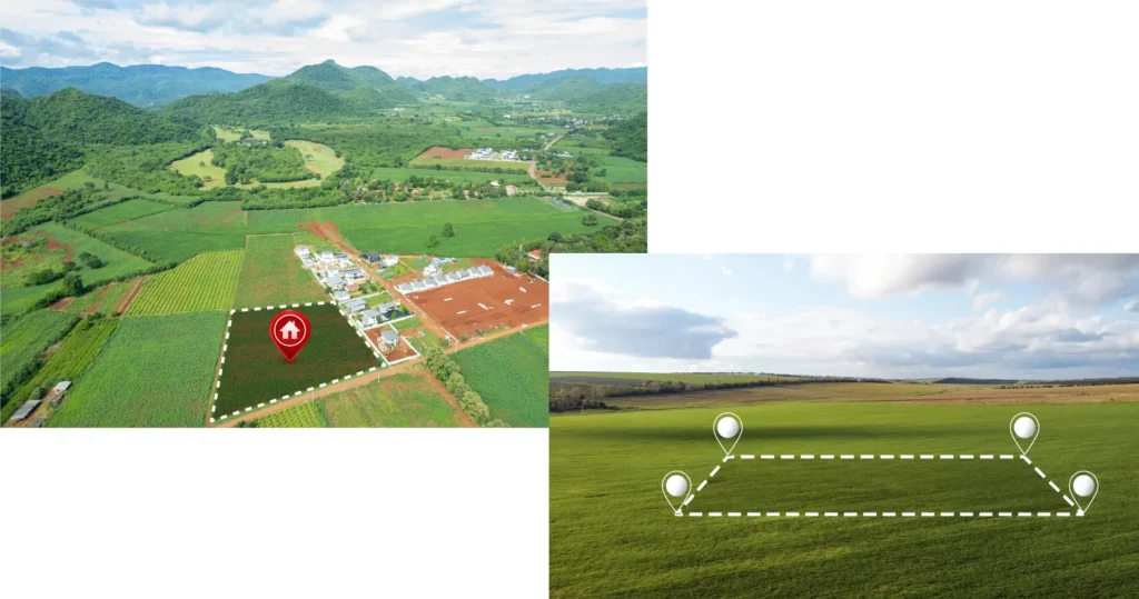
Call Rise Geo for Aerial Mapping of Your Projects
Bring revolution to your construction, development, and environmental projects with high-resolution aerial mapping surveys. Capture details of your site, generate precise 3D models, and gain valuable insights for informed decision-making throughout the project lifecycle – from planning and design to volume calculations and environmental impact assessments. Rise Geo Surveys offers drone surveys to acquire aerial data and produce surveys for difficult-to-access areas, such as quarries. This makes surveying accessible to areas that were previously too expensive or out of reach.
INQUIRE NOW

100+
Projects Completed In Last 5 Years

100+
Happy Clients
Aerial Mapping Survey Department of Rise Geo Surveys Specializes in the Following Services
- Pre-Construction Planning:
- Existing structures and vegetation
- Topography and elevation changes
- Potential environmental concerns
- Construction Monitoring & Management:
- Monitor adherence to plans
- Identify and address potential delays
- Optimize resource allocation
- Post-Construction Analysis & As-Built Surveys:
- Project completion verification
Volume calculations for final quantities - Future maintenance and development planning
- Project completion verification
- Infrastructure Inspections:
- Bridges and roadways
- Pipelines and power lines
- Solar farms and wind turbines
- Environmental Impact Assessments:
- Vegetation health and habitat mapping
- Erosion risk assessment
- Environmental impact monitoring over time
- Orthomosaics:
- Volume Calculations:
- Construction Progress Monitoring:
- Environmental Monitoring:
- Site Inspections:
- Boundary Surveys:
- Thermal Imaging:
- Identifying potential energy inefficiencies in buildings
- Detecting underground utilities or water leaks
- Monitoring environmental concerns like wildfires
- Lidar Surveys:
- Creating precise digital elevation models (DEMs)
- Mapping complex terrain and vegetation
- Supporting archaeological and historical site surveys
- Multispectral Imaging:
- Analyze vegetation health and identify potential crop stress
- Detect mineral deposits for mining exploration
- Monitor water quality and pollution levels
- Disaster Response & Damage Assessment:
- Damage visualization and quantification
- Facilitating emergency response and recovery efforts
- Supporting insurance claims processing
- Custom Solutions:
- High-Resolution Data Capture:
- 3D Modeling:
- Topography & Elevation Mapping:
- Progress Reporting:
- Timely Service
- Detailed Mapping
- Expertise
Introduction to the Aerial Mapping Survey
Imagine having a bird’s-eye view of your entire project site, capturing every detail with incredible accuracy. This is the power of aerial mapping surveys. It’s a revolutionary technology that utilizes aircraft, drones, and advanced sensors to gather high-resolution data and create detailed 3D models of your land.
Why Choose Aerial Mapping Surveys?
Traditional ground surveying methods can be time-consuming, labor-intensive, and limited in scope, especially for large or complex sites. Aerial mapping surveys offer several advantages:
Unmatched Efficiency: Cover vast areas quickly and efficiently, saving you time and money compared to traditional methods.
Enhanced Accuracy: Capture intricate details with high-resolution imagery and precise 3D models, leading to better decision-making.
Improved Safety: Access hard-to-reach or hazardous areas without putting personnel at risk.
Valuable Insights: Gain a comprehensive understanding of your site’s topography, vegetation, and existing structures.
Data-Driven Decisions: Support informed decision-making throughout your project lifecycle, from planning and design to construction and environmental monitoring.
Applications of Aerial Mapping Surveys:
Aerial mapping surveys are a versatile tool used across various industries, including:
Construction: Plan site development, track progress, and calculate volumes for efficient material management.
Development: Identify optimal development locations, assess environmental impact, and create detailed site plans.
Environment: Monitor vegetation health, analyze erosion risk, and track environmental changes over time.
Infrastructure: Inspect bridges, pipelines, and power lines for maintenance and safety purposes.
Mining & Exploration: Map complex terrain, identify potential mineral deposits, and support geological surveys.
Ready to Take Your Project to New Heights?
Aerial mapping surveys offer a powerful way to gain valuable insights and make informed decisions for your project. With a wide range of services available, you can tailor a solution to meet your specific needs.

What is the purpose of an aerial map?
Aerial mapping can provide a more comprehensive and accurate view of the area being mapped compared to traditional ground-based mapping methods. The data captured during aerial mapping can be processed to generate detailed maps, 3D models, or topographic data.
How does a drone survey work?
A drone survey is a cost-efficient way to map the area below. They are also referred to as UAV (Unmanned Aerial Vehicle) surveys or UAS (Unmanned Aerial System) surveys. The UAV is outfitted with cameras and propelled into the air by motors and propellers. They can be controlled by a remote ground control system, also known as a ground cockpit.
Why use a drone survey?
Drones, once a novelty, are now versatile and invaluable tools for surveying. There are many benefits to using a drone.
Cost Effective
Previously, an aerial survey required hiring a cherry picker or scaffolding, setting it up, conducting the survey, and then taking it down. Using a drone means not having to hire supplementary equipment, which saves money on equipment hire, set-up, and take-down time.
Time Effective
High-quality photographic and video records can be taken in a couple of hours.
Improved Health and Safety
Using heavy equipment at height increases the risks of falls and other on-site incidents. With a drone survey, no one works at height, eliminating the chance of a fall.
Minimal Disruption to Property
When surveying with traditional equipment, access to the site would often have to be closed off, and operations suspended for the time of the survey. Using a drone minimizes disruption to the surveying area.
Surveying Inaccessible Locations
Cumbersome equipment often prevented them from effectively surveying areas. A drone can go places a surveyor can’t, such as pitched roofs, quarry edges, and dangerous areas.
What type of surveys can we do with a drone?
• Land and topographic surveys
• Quarry and mineral surveys
• Construction sites
• Infrastructure and property
• Environmental and forestry
This ensures pilots have the proper training and examinations to fly a drone for commercial purposes and accept legal responsibility for their drones.
